
Demnate is a small market town at the foot of the High Atlas, about 105 km east of Marrakech by road. The drive from Marrakech to Demnate takes about 1 hour 45 minutes to 2 hours. The Imi n’Ifri natural bridge lies about 6 km east of the town, in a gorge cut by a mountain stream. Ouzoud lies north-east of Demnate, about 65 km away by road. Together, the town, the bridge and the Ouzoud waterfalls make a full day out from Marrakech with a private driver.
Where is Demnate, and how far is it from Marrakech?
Demnate sits in Azilal province, in the Béni Mellal-Khénifra region of central Morocco. The town stands at about 970 metres above sea level, where the plain gives way to the first ridges of the High Atlas.
The road distance from Marrakech is about 105 km. Most of the drive crosses open farmland before the road reaches the foothills. With a short coffee stop, plan on about two hours each way.
The natural bridge is the main reason to make the trip, and it links easily with the waterfalls further north. If the waterfalls are your main goal, our Ouzoud waterfalls day tour from Marrakech covers the classic route, and a private driver can be arranged to add Demnate and Imi n’Ifri on the way.
What is the Imi n’Ifri natural bridge?
Imi n’Ifri is a natural rock arch spanning a narrow gorge just east of Demnate. The name is Amazigh and means “mouth of the cave”.
The bridge is built largely of travertine. Travertine is a limestone deposited by mineral-rich spring water, layer by layer, over very long periods. Geologists describe the arch as the surviving part of a large cave whose roof has mostly collapsed. What remains is a thick rock vault with daylight entering from both sides.
The site is classified in Morocco as a site of biological and ecological interest. It is also one of the geosites of the M’Goun Geopark, which joined the UNESCO Global Geoparks network in 2014. The geopark covers roughly 5,700 square kilometres of the central High Atlas, and the Ouzoud waterfalls are part of it too.
The road from Demnate runs along the top of the gorge. The viewpoint beside the road sits right above the arch, so the bridge itself is best seen from below.
How do you walk down into the gorge?
A stepped footpath leads from the roadside down into the gorge. It is a few hundred steps to the bottom. From there the path continues under the arch and along the stream.
The walk is short but uneven. Some sections are exposed, with drops and no railings. Sure footing and a head for heights are needed. After rain, parts of the trail can be muddy and slippery.
The stream at the bottom is usually shallow, and boulders help you cross it. In wetter months, small waterfalls run down the walls of the gorge. Birds such as swifts and choughs nest in the cliffs and under the vault.
Allow up to about two hours for the full loop down, under the arch and back up. Local guides often wait near the car park. A guide is not required, but one can be helpful on the exposed ledges.
Good walking shoes are the most important item. Bring water, as the climb back up is steep in places.
What is the history of Demnate?
Local tradition dates the founding of Demnate to the late 10th century. The town grew as a trading point between the Atlas valleys, the regions to the south, and Marrakech.
Demnate was a walled town. Late-19th-century descriptions record crenellated ramparts with towers and several gates. The kasbah had its own enclosure, which held the main mosque and the house of the local governor. Parts of the old ramparts can still be seen today.
Demnate was also home to a long-established Jewish community. The community is recorded from around the 12th century and was known for winemaking and leatherwork. Most of its members emigrated in the mid-20th century. Accounts from the late 19th century describe Jewish and Muslim families living side by side within the walls.
Today Demnate is a working market town rather than a showpiece. Its interest lies in everyday life, the old walls and the setting at the edge of the mountains.
When is the weekly souk in Demnate?
The weekly souk in Demnate is held on Sunday. It sets up near the old town walls and draws people from the surrounding villages.
The souk is a working market for the town and its villages, not an event staged for visitors. If you want to see it, plan your day around a Sunday and stop in Demnate in the morning, before heading to the gorge.
Can you see dinosaur footprints near Demnate?
Yes. Dinosaur footprints are preserved in the Iouaridène area, further east along the road beyond the natural bridge.
The tracks are pressed into red sedimentary rock from the Late Jurassic period. Researchers have identified footprints of large plant-eating sauropods and of meat-eating theropods at the site.
The tracks lie in a fenced area beside the road and are simply presented. It is worth a stop if you have time and an interest in geology, but it adds time to an already long day. Ask your driver to confirm access before you set out.
How do you combine Demnate with the Ouzoud waterfalls?
Ouzoud lies north-east of Demnate, about 65 km away by road. The drive takes a little over an hour on a winding mountain road.
A practical loop runs from Marrakech to Demnate, out to Imi n’Ifri, then north to Ouzoud, and back to Marrakech. Ouzoud is about 150 km from Marrakech, and the return drive takes about 2.5 to 3 hours.
The full loop involves about six hours of driving in total. That leaves enough time for the gorge walk and a few hours at the falls, but it makes for a long day. An early start from Marrakech helps.
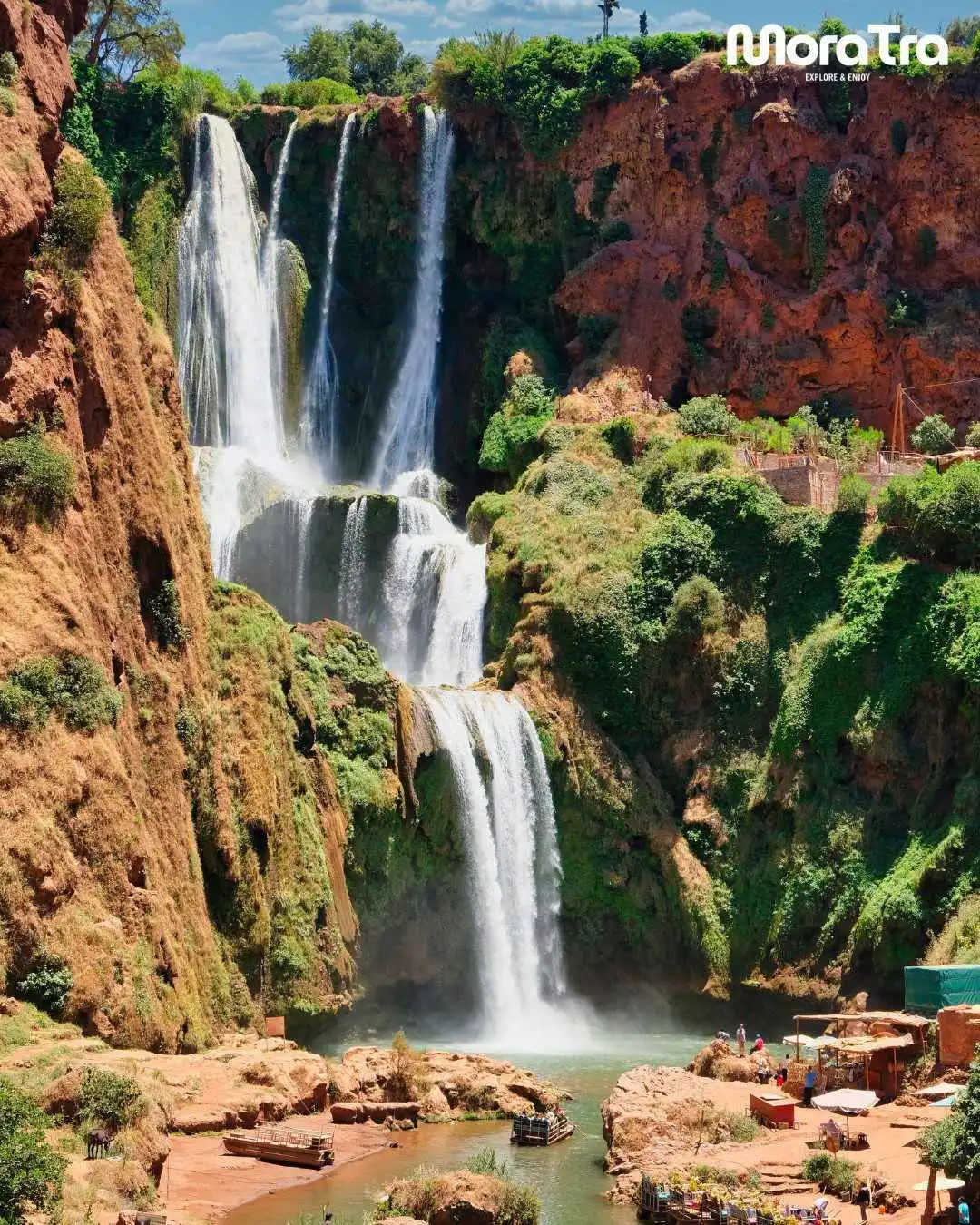
The Ouzoud waterfalls drop about 110 metres into a gorge. For what to expect at the falls, see our Ouzoud waterfalls guide.
When is the best time to visit?
Spring, from March to May, is the best season for this trip. The streams are flowing, the waterfalls at Imi n’Ifri and Ouzoud are at their fullest, and the countryside is green.
Autumn is also comfortable for walking. Summer afternoons are hot, and some of the smaller waterfalls in the gorge may dry up. In winter, the path into the gorge can be wet and slippery after rain.
Key facts
| Topic | Key fact |
|---|---|
| Location | Demnate is in Azilal province, at the foot of the High Atlas. |
| Distance from Marrakech | About 105 km east of Marrakech by road. |
| Drive time from Marrakech | About 1 hour 45 minutes to 2 hours. |
| Altitude | About 970 metres above sea level. |
| Imi n’Ifri | A natural travertine arch about 6 km east of Demnate. |
| Name meaning | Imi n’Ifri means “mouth of the cave”. |
| Gorge walk | A stepped path of a few hundred steps; allow up to about two hours. |
| Geopark | Part of the M’Goun UNESCO Global Geopark since 2014. |
| Weekly souk | Sunday. |
| Dinosaur footprints | Late Jurassic tracks in the Iouaridène area, east of the bridge. |
| Demnate to Ouzoud | About 65 km by road, north-east of Demnate. |
| Best season | Spring, from March to May. |
Is Demnate worth a day from Marrakech?
Demnate suits travellers who have already seen the main sights near Marrakech and want a quieter side of the Atlas foothills. The natural bridge is the highlight, the Sunday souk adds local life, and the Ouzoud waterfalls round off the day. For more ideas, browse our day trips from Marrakech, or ask us anything about planning this route with a private driver.
Frequently asked questions
How far is Demnate from Marrakech?
Demnate is about 105 km east of Marrakech by road. The drive takes about 1 hour 45 minutes to 2 hours in a private vehicle.
How far is the Imi n’Ifri natural bridge from Demnate?
The Imi n’Ifri natural bridge lies about 6 km east of the town. It is a short drive from the centre, and a stepped path leads down into the gorge beneath the arch.
How far is Ouzoud from Demnate?
Ouzoud lies north-east of Demnate, about 65 km away by road. The drive takes a little over an hour, so the two places combine well in one long day.
What day is the souk in Demnate?
The weekly souk in Demnate is held on Sunday. Plan a Sunday morning stop in town if you want to see it.
Is the walk into the Imi n’Ifri gorge difficult?
The walk is short but steep and uneven, with some exposed sections and no railings. Good walking shoes are essential, and the path can be slippery after rain.
