
Ifrane and Midelt are the two Middle Atlas towns on the road from Fes to Merzouga. Ifrane sits at about 1,665 metres, some 65 km south of Fes on the N8; Midelt lies at about 1,500 metres on the N13, roughly 210 km from Fes. This guide covers the distances, drive times and mountain passes, the cedar forest near Azrou, and how the mountain stage fits a one-way Sahara crossing.
Where are Ifrane and Midelt on the road from Fes to Merzouga?
The drive from Fes to Merzouga is about 470 km, or seven to nine hours of driving. It heads south through the Middle Atlas by Ifrane, Azrou and Midelt, then follows the Ziz Valley down to Errachidia, Erfoud and Rissani before the dunes of Erg Chebbi.
The mountain stage is the first part of the journey. Ifrane comes after about an hour, Azrou some 20 minutes later, and Midelt after three and a half to four hours of driving from Fes. Our 4-day Marrakech to Fes desert tour runs the same road in the other direction: the third night is spent in Midelt, and day four climbs through the cedar forests near Azrou and passes Ifrane on the way into Fes.
Our Fes to Merzouga desert tour guide compares the one-way crossings, from three to six days.
How far is Ifrane from Fes, and how high is it?
Ifrane lies about 65 km south of Fes on the N8, a drive of roughly 1 hour. The town stands at about 1,665 metres above sea level, high enough for snow in winter and cool, green summers.
The French administration founded Ifrane in 1929 as a summer hill station. Its chalets with steep red roofs, its parks and its lakes earned it the nickname “the Switzerland of Morocco”. Ifrane also holds the lowest temperature ever recorded in Africa, −23.9 °C, measured in February 1935.
Two landmarks make the classic stop in town:
- The stone lion, carved from a single rock around 1930, is the town’s best-known landmark. Who carved it is still debated.
- Al Akhawayn University was founded by royal decree in 1993 and opened in January 1995. It is a public, not-for-profit university that teaches in English, and its name means “the two brothers”.
What is there to see between Ifrane and Azrou?
Azrou lies about 19 km south-west of Ifrane, a drive of 20 to 25 minutes, where the N8 meets the N13. By road it is about 85 km south of Fes, roughly an hour and a half. The slopes around the town are covered in Atlas cedar and holm oak.
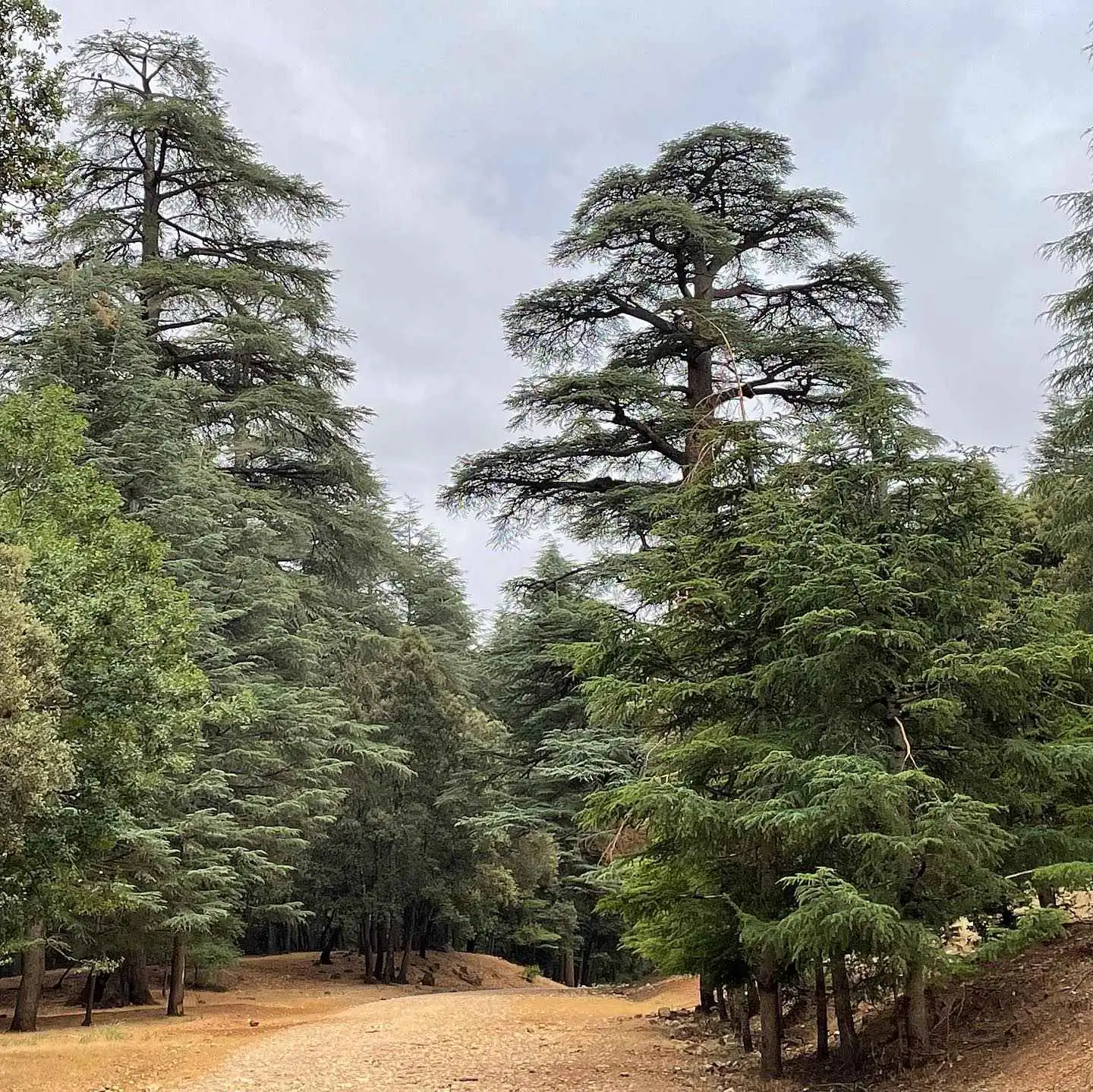
The Cèdre Gouraud forest, named after the French general Henri Gouraud, lies along the N8 between Azrou and Ifrane. It is the best-known place on the route to meet Barbary macaques, which often sit by the roadside. The Barbary macaque is an endangered species, so watch them from a few metres away and do not feed them.
Allow 30 to 45 minutes for a stop in the cedars. In winter the forest can be under snow.
What is Midelt known for?
Midelt is a plateau town at about 1,500 metres, on the high plains between the Middle Atlas and the High Atlas. It lies about 120 km south-east of Azrou on the N13, a drive of a little over 2 hours, and about 210 km from Fes in total.
The town is known for its apple orchards, which flower in spring and are harvested in autumn. Its national apple fair, the Salon national de la pomme, was held from 8 to 11 October in 2026.
Jbel Ayachi, at about 3,750 metres, rises some 30 km south-west of the town and often keeps its snow well into spring. It belongs to the eastern High Atlas, not the Middle Atlas.
Midelt makes a good overnight stop. It splits the Fes to Merzouga drive into two easier days: the mountains on the first, the Ziz Valley and the dunes on the second.
Which mountain passes does the road cross?
Between Azrou and Midelt, the N13 climbs over the Col du Zad, at about 2,180 metres, above the village of Timahdite. South of Midelt, the same road crosses the eastern High Atlas at the Tizi n’Talghemt pass, at about 1,907 metres, then descends past Rich through the Ziz Gorges towards Errachidia.
From Midelt, Errachidia is about 136 km on the N13, roughly 2 hours 15 minutes. Merzouga is then about 125 km further via Erfoud and Rissani, around 2 hours.
These are the stops worth planning for, from north to south:
- Ifrane, for the stone lion and a short walk through the town.
- The Cèdre Gouraud forest between Ifrane and Azrou, for the cedars and the Barbary macaques.
- The Col du Zad, the high pass on the N13 above Timahdite.
- Midelt, for a night among the apple orchards below Jbel Ayachi.
- The Tizi n’Talghemt pass and the Ziz Gorges, on the way down to Errachidia.
Can snow close the road in winter?
Yes. Heavy snow can close sections of the Middle Atlas roads for a day or more. In recent winters, snow has closed the N13 between Azrou and Timahdite, and in some storms the N8 around Azrou as well.
Between December and March, keep a spare half-day in your plan and check conditions on the morning you leave Fes or Merzouga. On a private trip, the timing can be adapted to the road.
When is the best time to drive through the Middle Atlas?
Spring and autumn are the most comfortable seasons, roughly April to June and September to October. Spring brings the orchard blossom around Midelt, and autumn the apple harvest.
Summer is the season Ifrane was built for: the town stays cool while the plains below are hot. Winter brings snow to Ifrane and the cedar forests, beautiful to see but slower on the road.
How long should you spend in Ifrane and Midelt?
Ifrane and the cedar forest near Azrou need about two hours together, with a walk in town and a stop with the macaques. Midelt works best as a night’s stop rather than a sightseeing day.
If you start from Fes, a night in Midelt leaves a shorter second day to Merzouga, with time for the Ziz Valley viewpoints. Our Fes travel guide helps you plan the days in the city at the start or end of the crossing.
What are the key facts about Ifrane and Midelt?
This table gathers the practical figures in one place.
| Topic | Key fact |
|---|---|
| Altitude of Ifrane | About 1,665 m |
| Fes to Ifrane | About 65 km on the N8, roughly 1 hour |
| Ifrane to Azrou | About 19 km on the N8, 20 to 25 minutes |
| Azrou to Midelt | About 120 km on the N13, a little over 2 hours |
| Altitude of Midelt | About 1,500 m |
| Midelt to Errachidia | About 136 km on the N13, roughly 2 hours 15 minutes |
| Fes to Merzouga in total | About 470 km, 7 to 9 hours of driving |
| Col du Zad, on the N13 | About 2,180 m |
| Tizi n’Talghemt, on the N13 | About 1,907 m |
| Jbel Ayachi | About 3,750 m, in the eastern High Atlas |
| Lowest temperature recorded in Ifrane | −23.9 °C, in February 1935 |
| Best seasons for the drive | April to June and September to October |
Ifrane and Midelt turn the long road between Fes and the Sahara into a journey through cedar forest, apple country and high passes. Take the mountain stage slowly, with a night in Midelt, and the dunes of Erg Chebbi come into view the next afternoon. You can browse all our Morocco desert tours, or ask us anything — we answer for free, with no obligation.
Frequently asked questions
How far is Ifrane from Fes?
Ifrane is about 65 km south of Fes on the N8, a drive of roughly 1 hour. It stands at about 1,665 metres in the Middle Atlas. Azrou and its cedar forest are about 19 km further south-west on the same road.
Where can you see Barbary macaques near Azrou?
The best-known place is the Cèdre Gouraud forest, on the N8 between Azrou and Ifrane, where the macaques often sit by the roadside. The species is endangered, so keep a few metres away and do not feed them. A stop of 30 to 45 minutes is enough.
How far is Midelt from Errachidia and Merzouga?
Midelt is about 136 km from Errachidia on the N13, roughly 2 hours 15 minutes, over the Tizi n’Talghemt pass and through the Ziz Gorges. Merzouga is about 125 km beyond Errachidia, via Erfoud and Rissani. Allow about four and a half hours of driving from Midelt to the dunes.
Is Jbel Ayachi in the Middle Atlas?
No. Jbel Ayachi, at about 3,750 metres, belongs to the eastern High Atlas. It rises some 30 km south-west of Midelt and is the snowy massif you see from the town in winter and spring.
Can snow close the road between Fes and Midelt?
Yes, for a day or more after heavy snow. The N13 between Azrou and Timahdite has been closed by snow in recent winters, and the N8 around Azrou in some storms. From December to March, keep a spare half-day and check conditions before you leave.
